When I visited Death Valley National Park for the first time in October, 2022, I took the route that led past the park’s Charcoal Kilns. I only spent a few hours at the park that visit, but I planned to be more flexible with my time on the second trip. The drive into the park brought me north on CA 178 with numerous sharp turns and a dip or two in the road that were more reminiscent of roller coaster drops. I had ordered a cheap dash camera in the hope that I could get a few moments recorded of scenic drives to add.
One of Shaka Guide‘s features is that it can help you find the starting point for the audio tour. The route I chose took me towards Furnace Creek, which is known for holding world records for high temperatures.
 I recalled how expensive gas was in the area around Death Valley, but I still decided to fill up the tank of my rental at a gas station in the village of Furnace Creek outside the park rather than chance entering the park with less than a full tank. The cost was still painful, but not as high as it was during my previous visit.
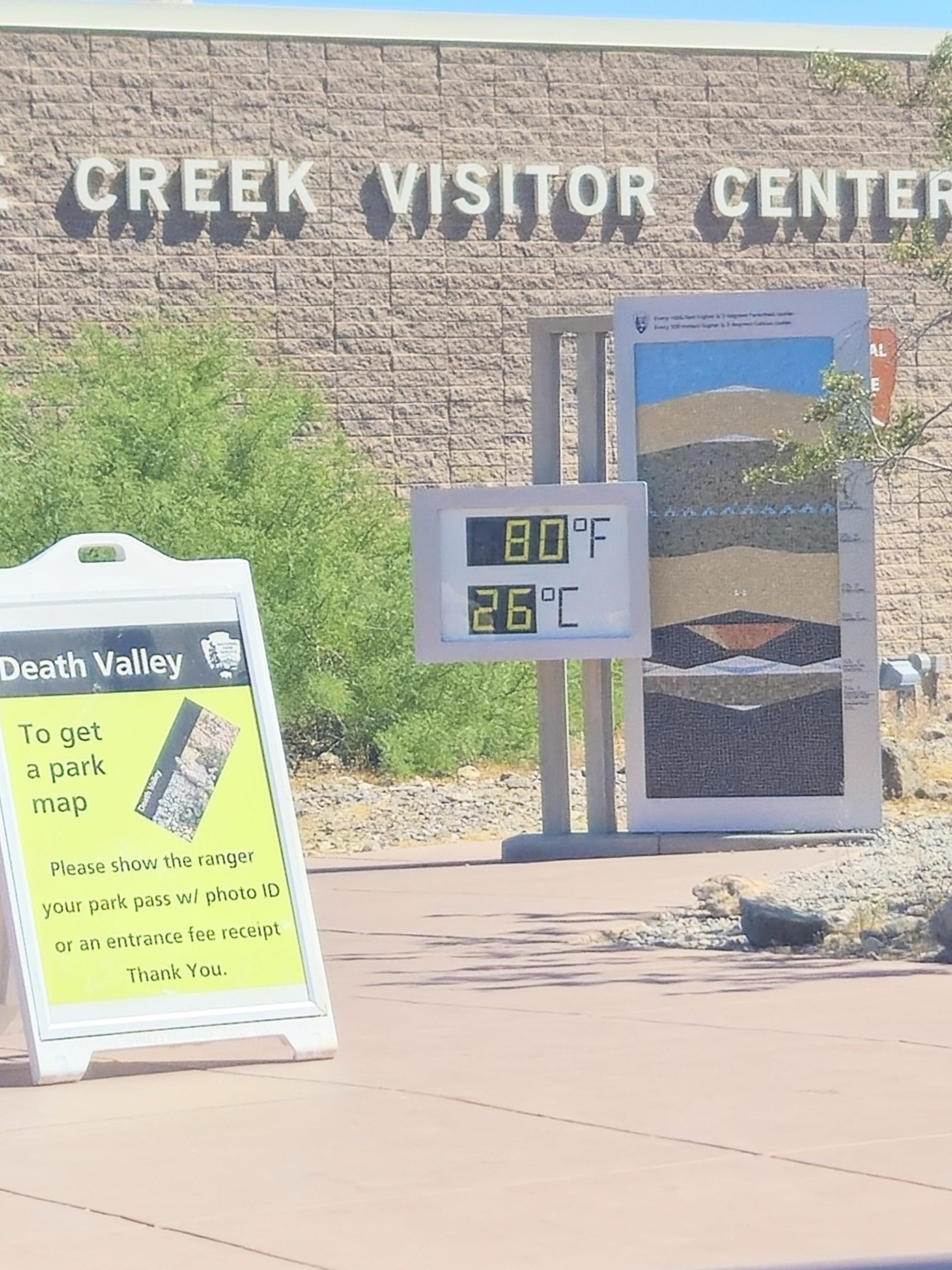
That day’s temperature, which was 80 degrees when I drove by the Furnace Creek Visitor Center, stayed in the 80’s during that day. Fortunately, this felt pretty comfortable to me. I didn’t go inside the visitor center since I had done so during my last visit and didn’t feel a need to add souvenirs from this trip.
An early turnoff from the roadway went to the Devil’s Golf Course. That road immediately turned rocky and more difficult to travel than I wanted to put a car I didn’t know through, so I turned back and returned to the main road.
Badwater Basin
The next point of interest was the Badwater Basin, which is a salt flat that reaches the lowest elevation in North America at 282 feet below sea level. Visitors were able to walk onto the basin, and there were salt tracks all along the entry to the basin. The thought of having to vacuum out salt from my rental before returning it didn’t strike my fancy. I was perfectly satisfied taking various pictures of those who had ventured out there.

 I then drove through Artist’s Drive and Palette that displayed an extraordinary view of colors against the Black Mountains. I could see why vehicles longer than 25 feet were prohibited due to the sudden dips and turns in the road.
From Dante’s View
Lastly, I reached Dante’s View, which stands at 5,500 feet above sea level. The audio guide stated that, on a clear day, one could see both the lowest point (Badwater Basin) and the highest point in the contiguous United States, Mt. Whitney in the Sierras. Fortunately for me, it was a beautifully clear day, so I could get pictures of both perspectives.
The view of the basin and of Telescope Peak–the highest point within Death Valley–from Dante’s View is the featured photo at the top of this blog post. The picture of Mt. Whitney as seen from Dante’s View is below.

The pictures from the day’s visit to Death Valley are located at https://singin1.click/piwigo/index.php?/category/12.

As always, I thank the Lord for granting me the stamina to make the trip, the damn good reflexes to steer the Silver Bullet (SB)–or whatever I am driving–as she needed to be guided, and the ability to enjoy His handiwork as it whizzes by my windshield.
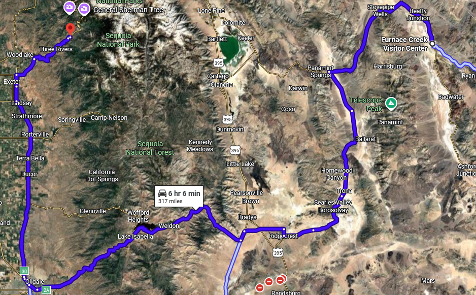
I had more than a six-hour drive to my next destination, Sequoia and Kings Canyon National Parks, and I wanted to get there before the parks got crowded. So far, my luck had held up on this front, but more popular parks were yet to come.
Also, I’m getting used to the Nissan Rouge that I rented for this trip. She is a bigger SUV than SB but does handle fine. The car is a steady ride, but I do miss the comfort zone I’ve found driving SB for over five years and 80+ thousand miles.